the National Library of Sweden
Digital cartography - that is computer cartography - could be seen from several different viewpoints. Three aspects are important for libraries: digital map production, digital access and digital archiving.
PRODUCTION
Computer-aided cartography was introduced in Sweden in the 1960s in the form of analogue plotters. Digital data appeared in the early 1980s, and the last ten years have seen the breakthrough of digital map production methods. This is due to the availability of software that makes it possible to produce maps by digital methods which are almost equally attractive to the eye as those produced with traditional methods. But the great majority of digital maps belong to fields where accuracy is more important than attractiveness, such as the municipal technical services, especially the subterranean systems for water, sewage, electricity and gas.
The National Land Survey introduced digital production methods for the printed maps several years ago. They now have databases for the different map scales, containing the usual map data: topography, administrative subdivisions, vegetation and land use, cadastral information, placenames, buildings and roads. They are marketed under the product name Geographic Sweden Data, GSD, with prices ranging - for the entire country - from SEK 82,000 for the 1:250,000 map up to SEK 17.5 million for the cadastral 1:10,000 map.
ACCESS
In Sweden as well as in Europe in general, spatial data is not in the public domain, in contrast to the United States. It is argued that the cost of spatial data should be paid for by the user. The datasets are seen as cost-recovering assets for the spatial information producers. Therefore the main prerequisite for digital cartography in libraries is lacking in Europe. This is analogous to the case for electronic publication in general, where the Internet attack on copyright has been met by publishers with restrictions on the right to fair use of electronic documents, which is essential to libraries.
Since 1994 Sweden has experienced legal deposit for electronic documents in a fixed form, i.e. CDs and floppy disks, including maps, but not for databases. Delivery has been reluctant and delayed. To date, some fifty map CDs have been received by the Royal Library. It is mainly the Land Survey topographic maps, at scales of 1:50,000, 1:100,000 and 1:250,000, but also a few route-planners, ‚ArcSverige’, an adminstrative and statistical dataset in ArcView format intended for business applications and some geological maps in Acrobat format. Cataloguing is done according to the new ISBD(ER) with the difference that we set the General Material Designation to ‚Cartographic Materials’. It also includes the installation of the applications in order to display the electronic ‚title pages’ if there are any, which is often not the case.
The Land Survey CDs contain raster maps, mainly without elevation contours. (Contours are found however on the 1:250,000 and the northern part of the 1:100,000 map.) We use them for:
- Simple printouts for patrons (having acquired now a colour printer for A2 size).
- Placename search for patrons.
- Finding co-ordinates for our own cataloguing of maps.
For examples see figures 1 and 2.
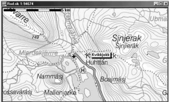
Figure 1
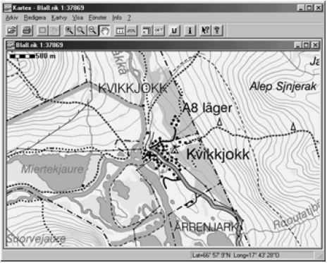
Figure 2
The Library has also acquired a small number of electronic atlases, Encarta etc., which will be mounted in a CD network for the public, but this has not yet been put into practice.
The previous MS-DOS version of the Swedish National PC-Atlas, which I have demonstrated several times at LIBER conferences, is no longer updated. It was useful because of the map catalogue with a graphic interface, where we could also insert entries. The new PC-Atlas version, which is ArcView based, does not contain this module. The map sheet indexes of the official maps have been moved to the Land Survey website, which we cannot use.
So we are contemplating a graphic map catalogue interface of our own, based on the Digital Chart of the World (DCW). This would be similar to the ArcView sheet indexes made by Joachim Lamatsch of Germany and used by the ETH Library at Zürich. But they are rather expensive, and we need indexes not only for sheet maps but also for ‚monographic’ maps, preferably with interactive links to the catalogue entries.
Inspired by Wolfgang Crom’s Kraków presentation [see elsewhere in this issue], we have recently started publishing indexes of the old military topographic map of Sweden on our own website.1
We have downloaded the Swedish Digital Chart of the World (DCW) data in ArcView export format which can be taken, country by country, from the Pennsylvania State University website.2 The same data are distributed by ESRI on CDs in five-degree tiles. These are effectively the only digital map data in vector format available for GIS work in the library.
As mentioned earlier a CD ‚ArcSverige’ has now been published with Swedish administrative and statistical datasets in ArcView shapefile format intended for the business market. They can be combined with the Land Survey raster maps as background, but are not compatible with the DCW.
For a couple of years, the Swedish Land Survey has been running a Webmap service, where you can order extracts from the cadastral map and property register to be delivered by fax or e-mail. This has been a free service, but since December 1998 a rather high fee has been introduced. The Land Survey is also planning a maps-on-demand service, it is possible to design a customised map and have it delivered over the Internet. With such a system the role of the map library would become that of a computer station with colour printers and skilled staff to assist in the printing out of on-demand maps. The subsequent pricing structure would certainly be important.
PRESERVATION
A number of projects are underway for preserving original and electronic documents.
- Digitizing for preservation:
A large number of digitizing projects are run by libraries, archives and museums, but few of them have preservation quality, that is 500 dpi resolution. Map digitizing projects run by the Land Survey, i.e. digitizing of ancient cadastral maps via flatbed or film scanning, mainly at research needs, partly at preservation, but the resolution, which is 250 dpi, is almost insufficient for this purpose. Until now, the general opinion has been that preservation demands photography, while digitizing is for access. - Preservation of digital data:
In Sweden this is mainly a matter for the archives, with an increasing awareness of the need for a digital preservation policy with file format and other technical considerations, especially among government agencies.
Within libraries, the main initiative is the Royal Library’s Kulturarw3 project for collecting Swedish web pages, at present around nine million files (including a small number of map sites).
In connection with this there is a campaign to persuade webpage creators to include Dublin Core metadata to facilitate retrieval. (This is to be distinguished from the development of spatial metadata for analysis in the GIS world). The search engine ‚Svesök’ for Swedish webpages has been set up.3 A subject search on ‚Kartor’ (Maps) generates among others an interactive map of the city of Kristianstad.4
In August 1998 a State Commission report was published with proposals for the legal deposit of online electronic documents, which will eventually result in an amendment to the law on legal deposit. This mainly concerns the abovementioned Swedish webpages, but some online databases are also proposed for inclusion. It seems probable from the wording, however, that the spatial databases of the Land Survey will not be part of this.
REFERENCES
1 Generalstabens karta över Sverige, http://www.kb.se/kob/Generalstart. html.
2 Digital Chart of the World Server, http://www.maproom.psu.edu/dcw/.
3 Svesok search engine, http://www.svesok.kb.se/.
4 Interactive map of Kristianstad, http://www.kristianstad.se/karta/.
Göran Bäärnhielm
The Royal Library
PO Box 5039
10241 Stockholm, Sweden
Goran.Baarnhielm@kb.se