The map department of the Württemberg State Library in Stuttgart started a new development for the representation of its collection. When the Internet became increasingly important as an additional means for libraries and librarians to collect and distribute information, we wanted to include our map collection. However, we not only wished to bring attention to its existence but also to create the possibility of presenting the main information about the maps.
Many map collections do not provide their own map catalogue, so the user has the problem of finding a map in the general catalogue, especially if there is no regional or subject catalogue. Moreover, an electronic catalogue such as an OPAC does not serve them in a satisfactory way. In Germany we use the RSWK-rules for classification, which recognize only the formal term „Karte” (i.e. map) without a conditioning subject (such as geology, land-use map etc.). Another problem is the cataloguing of map series. The most important tool is the index-sheet, and this is not available in any catalogue. This was the starting point for our reflections and so we searched for a way to provide an easier means than a conventional catalogue.
Based upon our collection and the needs of the majority of our users (local historians, genealogists, students of architecture or geography) we compiled lists of the maps, for example of Lake Konstanz and its surroundings, or alphabetical lists of city maps from Baden-Württemberg. Hence every list contains all the maps pertaining to a theme ordered alphabetically or by year of publication as the case may be. The most interesting search option, however, is the use of sensitive index sheets (clickable maps) for the map series. By selecting parts of this index sheet it is possible to access any sheet within the series and be provided with a list of all the editions of this map in our collection.
All the lists were written with a PC-based word-processing programme and converted into HTML. Their presentation was designed using a fixed HTML document which provided the format of all our webpages: the heading indicating that this is a Württemberg State Library document, a sub-heading below this with the name of our map collection, in the left-hand column the navigation links (for both the library and the map collection) and in the main page area the document file (see any figure).
At this point, the starting page shows a regionally divided list of our document files, (figure 1) In the future, when more files are added, we will also offer a search facility by subject.
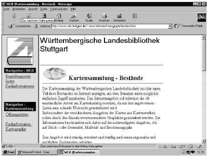
Figure 1
Figure 2: „Stuttgart: Umgebungskarten” (Stuttgart: surroundings) is an example of a list, sorted by publishing year, while figure 3: „Schweiz: Ortsumgebungskarten” (Switzerland: place surroundings) illustrates an alphabetical list of the locations. The documents contain a full description of the title and detailed information (coloured, contour or vertical hill shading).
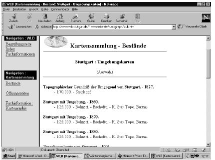
Figure 2
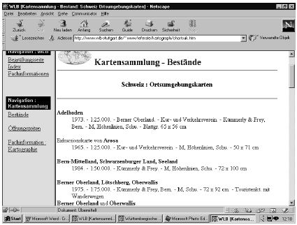
Figure 3
The collection of city maps is presented in a different way. Here we offer alphabetical lists of place names only with listings of year of publication (figure 4: „Baden-Württemberg: Stadtpläne”; here for example letter „C”), but without information concerning the scale, as the scale of a city map normally varies between 1:12,000 and 1:20,000.
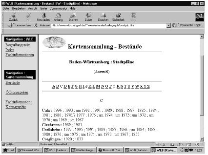
Figure 4
Finally for the map series we present the index sheet as a sensitive map like figure 5: „Baden-Württemberg : Serien - Topographische Karte 1:50,000” (topographical map series of Baden-Wuerttemberg 1:50,000). By selecting any sheet in this series (here: L6920 Heilbronn), the system provides information concerning all the editions of this sheet that we have (figure 6). In this way we can inform the user about a gap in this series. For the orohydrological map of the same area we copied the same index sheet and code for the co-ordinates in this document source. Only at the end of the reference there is information for finding the right file [for the index sheet see: http://www.wlb-stuttgart.de/∼www/referate/kartograph/bwoh50i.htm and for the same sheet of Heilbronn see http://www.wlb-stuttgart.de/∼www/referate/kartograph/oh50bw.htm#L6920OH].
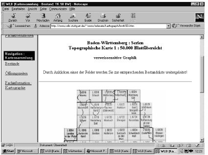
Figure 5
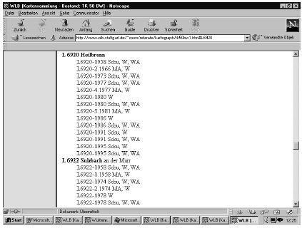
Figure 6
Hence we offer a special kind of catalogue with various forms of lists which are adaptable to the subject. We do not use the regular entries in all our lists and the shelf marks are not included. This information is not important for our users: they cannot take the maps out of the drawers themselves, but all the information necessary for finding a particular map is easily accessible. With this simple way of proving information we do not wish to replace our main map-catalogue, but aim to offer a quick and easy way to find a map in our collection. The user can search from home by the Internet before coming to the map department.
To summarize:
We have catalogued our maps of Baden-Württemberg, the main focus of our map collection, by means of special lists ordered by regional themes, alphabetical lists of city maps and sensitive index sheets of map series.
The search options within these systems vary according to the subject.
Wolfgang Crom
Württembergische Landesbibliothek
P.O. Box 10 54 41
70049 Stuttgart, Germany
crom@mailserver.wlb-stuttgart.de